| Graphics | |
Displaying Contours in Polar Coordinates
You can contour data defined in the polar coordinate system. As an example, set up a grid in polar coordinates and convert the coordinates to Cartesian coordinates,
Then, generate the complex matrix Z on the interior of the unit circle,
X, Y, and Z are points inside the circle.
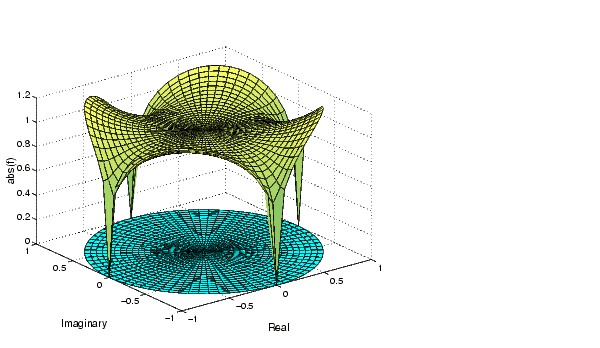
Create and display a surface of the function  .
.
Display the unit circle beneath the surface using the statements
Labeling the Graph
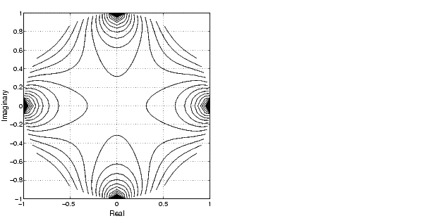
Contours in Cartesian Coordinates
These statements display a contour of the surface in Cartesian coordinates and label the x- and y-axis.
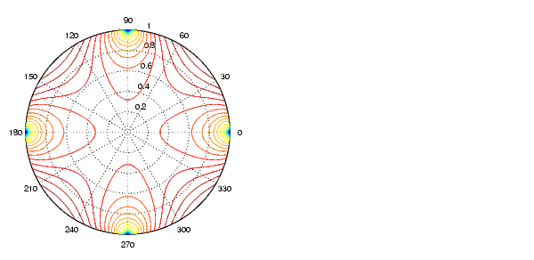
Contours on a Polar Axis
You can also display the contour within a polar axes. Create a polar axes using the polar function, and then delete the line specified with polar.
With hold on, display the contour on the polar grid.
| | Changing the Offset of a Contour | Interactive Plotting | |